
Hartwell Lake - South Carolina / Georgia
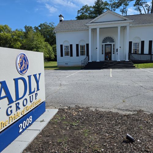
ADLY GROUP Realty “The Pride of Real Estate” Terri & Keith Perkins
Introduction
Hartwell Lake is one of the Southeast’s largest and most popular public recreation lakes. Built by the U.S. Army Corps of Engineers between 1955 and 1963 as part of a flood control, hydropower, and navigation project, authorized purposes now include recreation, water quality, water supply, and fish and wildlife management. Each year, millions of people utilize the many public parks, marinas, and campgrounds conveniently located around the lake to pursue a variety of outdoor recreational experiences - making Hartwell one of the most visited Corps lakes in the nation
Hartwell Lake is a man-made lake bordering Georgia and South Carolina on the Savannah, Tugaloo, and Seneca Rivers. The lake is created by Hartwell Dam located on the Savannah River seven miles below the point at which the Tugaloo and Seneca Rivers join to form the Savannah. Extending 49 miles up the Tugaloo and 45 miles up the Seneca at normal pool elevation, Hartwell Lake comprises nearly 56,000 acres of water with a shoreline of 962 miles. The entire Hartwell “Project” contains 76,450 acres of land and water. Interstate 85 bisects Hartwell Lake and makes the area easily accessible to visitors.
Hartwell Lake and Dam is the second Corps of Engineers project to be built in the Savannah River Basin. The first, J. Strom Thurmond Lake and Dam, was completed in 1952. A third project, Richard B. Russell Lake and Dam was completed in 1985. Congress authorized Hartwell in 1950 and construction began in October 1955. The project was completed in 1963 at a cost of more than $89 million. Did You Know?
- The Hartwell "Project" was originally authorized for three purposes: hydropower, flood control, and navigation. Later, recreation, water quality, water supply, and fish and wildlife management were added.
- Construction of the Hartwell Project took place from 1955 – 1963.
- Construction of the dam began in 1955 and was completed in 1959.
- Impoundment of the lake began in February 1961. The lake reached its full pool elevation of 660 feet on March 12, 1962.
- The powerplant was completed in 1961; the first generator went on-line at on April 27, 1962.
- The Hartwell Powerplant is a "peaking powerplant" - this means that power is not constantly generated. Instead, power is generated at times when electricity is in the greatest demand.
- Hartwell Lake contains 55,900 acres of water and has 962 miles of shoreline. 23,563 acres of public land surrounds the lake.
- The lake is located in two states (Georgia and South Carolina) and 6 counties (Georgia – Hart, Franklin, and Stephens Counties; South Carolina – Anderson, Oconee, and Pickens Counties).
- Hartwell Dam is built of more than 880,000 cubic yards of concrete (enough to build a sidewalk from the dam to San Francisco) and more than 3 million pounds of reinforcing steel.
- The depth of the lake behind the dam is approximately 180 feet.
- The top of the dam is 204 feet above the Savannah River Bed.
- The Hartwell Dam and Lake has prevented over $101,998 million in flood damages since 1962.
- Floodgates at the Hartwell Dam have been opened for flood control purposes three times - in 1964, 1965, and 1994. They have been opened at other times for maintenance and inspection purposes.
- The average yearly generation from the Hartwell Powerplant is approximately 470,000 - megawatt hours. Megawatt hours produced in 2008 were 217,423. The 2008 total is below average because of reductions in generation due to drought conditions in the Savannah River Basin in 2008.
- The three Corps managed lakes on the Savannah River - Hartwell, Richard B. Russell, and J. Strom Thurmond - are responsible for maintaining water supply and water quality needs of the Savannah River from below Thurmond Dam all the way to Savannah, Georgia and the Atlantic Ocean.
- The Savannah River forms at the confluence of the Tugaloo and Seneca Rivers, 7.1 miles above the Hartwell Dam.
- The Savannah River begins 7.1 miles above the Hartwell Dam and is approximately 315 miles long. The river ends in the Atlantic Ocean near Savannah, Georgia.
- The lowest lake level on Hartwell Lake is 637.49 ft. msl reached on December 9, 2008. The previous record low at Hartwell Lake was 642.4 ft. msl, reached on December 24, 1981.
- The highest lake elevation reached was 665.4 ft. msl reached on April 8, 1964.
- The average lake elevation is 657.5 ft. msl.
Lake Hartwell
Lake Hartwell | |
A finger of the lake extends into Clemson, SC. | |
Location | |
Coordinates | Coordinates 34.46524°N 82.845497°W |
Savannah River to Lake Russell | |
Basin countries | United States |
Surface area | 56,000 acres (23,000 ha) |
Average depth | 45 ft (14 m) |
Max. depth | 185 ft (56 m) |
Lake Hartwell is a man-made reservoir bordering Georgia and South Carolina on the Savannah, Tugaloo, and Seneca Rivers. Lake Hartwell is one of the southeast's largest and most popular recreation lakes. The lake is created by Hartwell Dam located on the Savannah River seven miles (11 km) below the point at which the Tugaloo and Seneca Rivers join to form the Savannah. Extending 49 miles (79 km) up the Tugaloo and 45 miles (72 km) up the Seneca at normal pool elevation, the lake comprises nearly 56,000 acres (230 km²) of water with a shoreline of 962 miles (1,548 km). The entire Hartwell "Project" contains 76,450 acres (309 km²) of land and water. I-85 bisects Hartwell Lake and makes the area easily accessible to visitors.[1]
Background
The Flood Control Act of 17 May 1950 authorized the Hartwell Dam and Reservoir as the second unit in the comprehensive development of the Savannah River Basin.44 The estimated cost was $68.4 million based on 1948 price levels and preliminary designs. The original project provided for a gravity-type concrete dam 2,415 feet long with earth embankments at either end, which would be 6,050 feet long on the Georgia side and 3,935 feet long on the South Carolina side. The 12,400-foot-long dam was to be topped with a roadway 24 feet wide. The main dam was to consist of two nonoverflow concrete sections on the right and left banks 887 feet and 940 feet long, respectively; a gravity-type concrete spillway 588 feet long equipped with 12 tainter gates 26 feet by 40 feet in the channel; and a powerhouse on the South Carolina side of the river.45 Full power pool was designed to be 660 feet above mean sea level. At this elevation, the reservoir would extend 7.1 miles up the Savannah River to the confluence of the Tugaloo and Seneca Rivers; 41 miles up the Tugaloo to within approximately 2 miles of the existing Yonah Dam; 27 miles up the Seneca to the mouth of the Little River, South Carolina; 2 miles up the Little River to the Newry site; and 7 miles up the Keowee to the Old Pickens site. The reservoir would cover 56,500 acres and would involve the relocation of 3 sections of railroad totaling 2 miles, the raising of 2 railroad bridges, construction of 6 sections of new state high- ways totaling 19.6 miles and 9 sections of county roads totaling 12.7 miles, the construction of 9 new bridges and the raising of 4 existing bridges, and the relocation of 2 power transmission lines.[2] Construction of the Hartwell project took place from 1955 and was completed in 1963. And construction of the dam started in 1955 and was finished in 1959.
Lake Hartwell is named for the American Revolutionary War figure Nancy Hart.[4] Nancy Hart lived in the Georgia frontier, and it was her devotion to freedom that has helped make her name commonplace in the Georgia upcountry today. A county, city, lake, state park and highway among others, bear her name. She married Benjamin Hart and moved to South Carolina where they parented a healthy family of eight children. It is difficult to know the truth about Nancy because there are many myths, hearsay, exaggeration and some imagination in stories that have been told about her. She was about 6 feet tall, could handle an axe or musket and wasn't afraid to use them, but above all she loved her freedom. Many stories have been told about this famous Revolutionary War heroine, and it with good reason that her name has become commonplace in land of her adventure.
The Droughts and water levels of Lake Hartwell 1989 was the first year the lake hit a level 3 dropping to its lowest level during the drought that year. 2008 was the second time the lake hit a level 3. In the year of 2008, due to severe drought in the southeastern United States, the lake dropped to over 22 feet (6.7 m) below its normal water level in December 2008. This revealed old highways that were typically underwater, exposed islands that are usually topped with buoys to warn boaters, and left some boat shells sitting on dry land.[6]
The Lake reached it lowest level, 637.49 ft. msl, on December 9, 2008. The highest lake elevation was 665.4 ft. msl, reached on April 8, 1964. Overall the average lake elevation is 657.5 ft. msl. As of the first of October 2010, the lake is back up to just over 654 feet, 6 ft lower than full pool of 660 ft. This rebound in lake level is due to releases from the lake being suspended for a month ending April 10, 2009 in an effort to return Lake Hartwell to normal elevations. As of July 2013, the lake level is 663 ft.
Early Lake History
The area around Lake Hartwell has a rich history, much of the land inherited from the Cherokee Indians and from early settlers. Many streams, rivers and recreation areas have been named after these early settlers. Issaqueena, a young Indian maiden who rode to Fort Ninety-Six to warn settlers of an attack, allegedly named some streams. Along her journey, she marked her travel by naming streams that she encountered for the number of miles she had covered. Issaqueena named Six-Mile, Twelve-Mile, Three-and-Twenty Mile and Six-and-Twenty Mile creeks, which are still a part of the lake today. Talked about earlier is Nancy Hart, for whom Hart County, Ga., Hartwell, Ga., and Hartwell Dam and Lake were named after her. A few other historic figures that lived around this area were Andrew Pickens and John C. Calhoun, both were Statesmen from South Carolina. William Bartram was another fellow that traveled the area recording vegetation types and plant species.
Challenges
The first challenge was in August 1956 when Mrs. Eliza Brock and her daughter refused to allow workmen to come on their property to begin clearing for the reservoir area. This involved 103 acres of land that the government gained ownership of in June 1956. Apparently Mrs. Brock never received the offer for her land therefore refusing to allow them on her property. After delaying construction, Mrs. Brock eventually settled on $6,850 for her property. The next challenge took place in late 1956 when Clemson College objected to the damage that would be done to its property as a result of the impounded water in the reservoir, including plans that would flood Memorial Stadium. After countless meetings Clemson finally settled on an agreement where two diversion dams would be built in the vicinity of Clemson College and rechannel the Seneca River.[9]
Hartwell Lake map
Fishing
Since its construction, Hartwell Reservoir has provided good fishing habitat for many species. Bream, catfish, smallmouth bass, walleye, and largemouth bass are naturally occurring species in the lake, with quality fishing available for those species. The most popular fishing on Lake Hartwell, however, has become pursuing striped bass. Striped Bass, also known as rock fish, were discovered to be able to survive in freshwater after the construction of a dam on the Santee-Cooper system in lower South Carolina trapped many striped bass in fresh water. Striped bass were eventually introduced to the three lower Savannah River System lakes: Hartwell, Russel, and Thurmond. The species has done well, but due to the need for moving water to successfully hatch eggs, must continually be stocked in the lakes. These fish provide anglers with a fishing challenge more likened to saltwater fishing, with anglers tending to use larger boats, conventional reels, and often trolling techniques. State record fish have come from all three of the lakes holding "stripers" on the Savannah River system. 60+ lb. fish have been caught on Lake Hartwell, with 20 lb. fish being common. The majority of striped bass caught on the lake will range from 5 to 12 pounds. The lake is also notorious for its Hybrid Striped Bass population.
Recreation
- Camping. The U.S. Army Corps of Engineers manages 9 campgrounds at Lake Hartwell with a total of 524 campsites. Many of the campgrounds include restrooms, showers, boat ramps, playgrounds, electric and water hook ups, courtesy docks, group camping, and designated swimming areas.
- Biking trail. The Corps of Engineers Lake Hartwell office partnered with the Southern Off-Road Bicycle Association(SORBA) to build a 7.6-mile multi-purpose trail at the Paynes Creek Campground area.
- Fishing. Hartwell is home to many different types of fish including largemouth bass, bream, hybrid and striped bass, crappie, white bass, trout, and walleye.
- Swimming. The lake is suitable for swimming but there have been over 200 deaths on the lake through the years.
- Water sports. The Lake is a venue for a variety of sports such as tubing, waterskiing, and wake boarding.
- Boating. Boating is a huge part of the recreation side of Lake Hartwell. There are five marinas along the lake, including Clemson Marina, Big Water Marina, Harbor Light Marina, Hartwell Marina, and Portman Marina as well as many public boat ramps. The lake also features the private Western Carolina Sailing Club that hosts an annual regatta in October to benefit Hospice of the Upstate.
- Wildlife. There are more than 250 species of birds and 40 different mammals around Lake Hartwell. In addition there are numerous aquatic, reptile and amphibian species there too. Some wildlife one may find includes wood ducks, chickadees, blue birds, screech owls, flying squirrels, wild turkeys, snakes, raccoons, and the great blue heron. Occasionally one may see a deer swimming across the water or drinking at the shore, even black bears have been spotted on the lake.
Places to Visit
- Issaqueena Dam. To find the Dam head north on the Keowee River, past Clemson, and you will take a right turn into this "magical cove" that contains a waterfall. It is about 25 feet tall and 150 feet wide overflow out of Lake Issaqueena into Lake Hartwell. Many people will drive or park their boats and hike around this area on a pretty day. Regardless of all the danger signs, people insist on sliding down the waterfall into the lake. Wear a lifejacket though because some tragedies have happened here before.[11]
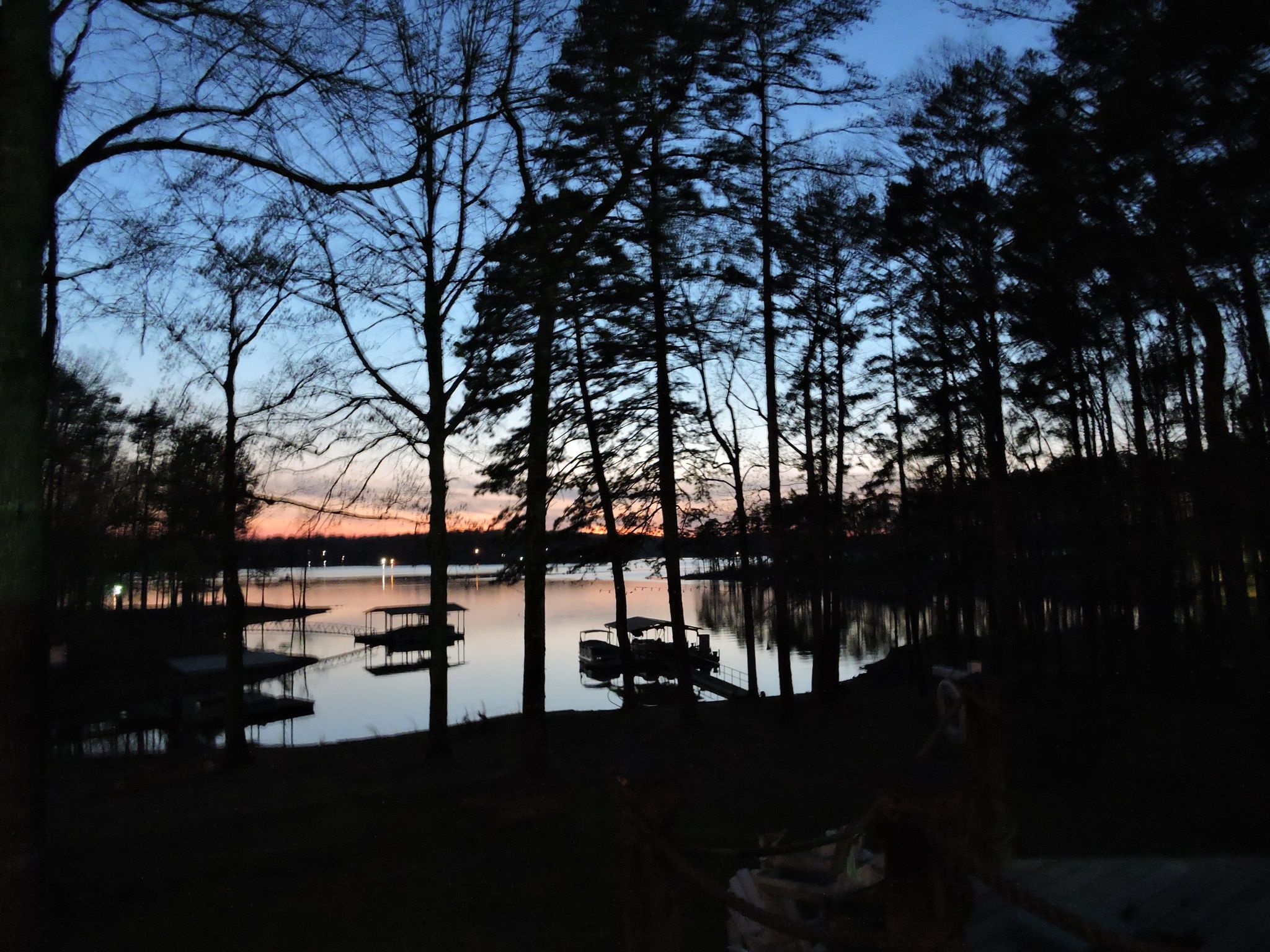
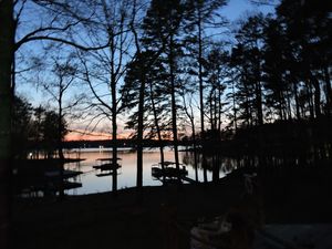
Sunset on the Lake with Portman Shoals Marina in the distance.
- Eighteen Mile Creek. Eighteen Mile Creek is not quite eighteen miles long, but it is a nice curvy and narrow waterway. It is off of the Seneca River at buoy marker S-42. It is well known for among fishermen and birds. The curvy waterway goes for about five miles and ends in a big shallow area and an old bridge with lots of birds and wildlife.[11]
- Rock Quarry. There are several overhanging rocks to leap from. The heights of the rocks vary with the changing lake levels. Some areas within this cove are shallower than others so be careful when jumping off the rocks.[11]
- Ghost Island. This is the largest island, heading toward Portman Marina from Oconee Point. When looking at the island search for the highest point, you can simply look for the tallest trees on the center of the island. Start hiking to this point and you may find as many as fifty grave headstones. Many of the stones are very small and cannot be read due to age and years of weather. There are several tomb-like, above ground concrete vaults with markers identifying the graves from the War of 1812. There are also graves from the 1700s. The area in which it is located looks like it could have been an old home place or church but the only thing left was the graves. Many people camp on this island unaware of their "company".[11]
- Andersonville Island. Andersonville, SC was once a well-known port and resort town with a barge system that traveled daily to Savannah, Ga.For many years this town flourished and had many businesses, factories, and tourists that would come from all around. Andersonville was said to be as large as Anderson, SC or Pendleton, SC, but all that is left is a large island nearly 400 acres in size. It is by far the largest island on the lake, between two and three miles long. It has a paved road that stretches from one side to the other but is grown over now. On the island one can find anything from building ruins, to artifacts, to rare plants and wildlife.
- Clemson Football. Clemson footballgames have always been a draw for boaters on Lake Hartwell. The University and stadium tower over the lake. During football season, boats from all over the lake travel up the Seneca River to come watch the games. You can park your boat on the left side of the long earth dike and walk up the hill to the famous Esso Club or to the game.
Check out this article next
Hartwell Lake - South Carolina / Georgia
ADLY GROUP Realty “The Pride of Real Estate” Terri & Keith Perkins
Introduction
Hartwell Lake is one of the Southeast’s largest and most popular public recreation lakes. Built by the U.S. Army Corps of Engineers between 1955 and 1963 as part of a flood control, hydropower, and navigation project, authorized purposes now include recreation, water quality, water supply, and fish and wildlife management. Each year, millions of people utilize the many public parks, marinas, and campgrounds conveniently located around the lake to pursue a variety of outdoor recreational experiences - making Hartwell one of the most visited Corps lakes in the nation
Hartwell Lake is a man-made lake bordering Georgia and South Carolina on the Savannah, Tugaloo, and Seneca Rivers. The lake is created by Hartwell Dam located on the Savannah River seven miles below the point at which the Tugaloo and Seneca Rivers join to form the Savannah. Extending 49 miles up the Tugaloo and 45 miles up the Seneca at normal pool elevation, Hartwell Lake comprises nearly 56,000 acres of water with a shoreline of 962 miles. The entire Hartwell “Project” contains 76,450 acres of land and water. Interstate 85 bisects Hartwell Lake and makes the area easily accessible to visitors.
Hartwell Lake and Dam is the second Corps of Engineers project to be built in the Savannah River Basin. The first, J. Strom Thurmond Lake and Dam, was completed in 1952. A third project, Richard B. Russell Lake and Dam was completed in 1985. Congress authorized Hartwell in 1950 and construction began in October 1955. The project was completed in 1963 at a cost of more than $89 million.
Did You Know?
- The Hartwell "Project" was originally authorized for three purposes: hydropower, flood control, and navigation. Later, recreation, water quality, water supply, and fish and wildlife management were added.
- Construction of the Hartwell Project took place from 1955 – 1963.
- Construction of the dam began in 1955 and was completed in 1959.
- Impoundment of the lake began in February 1961. The lake reached its full pool elevation of 660 feet on March 12, 1962.
- The powerplant was completed in 1961; the first generator went on-line at on April 27, 1962.
- The Hartwell Powerplant is a "peaking powerplant" - this means that power is not constantly generated. Instead, power is generated at times when electricity is in the greatest demand.
- Hartwell Lake contains 55,900 acres of water and has 962 miles of shoreline. 23,563 acres of public land surrounds the lake.
- The lake is located in two states (Georgia and South Carolina) and 6 counties (Georgia – Hart, Franklin, and Stephens Counties; South Carolina – Anderson, Oconee, and Pickens Counties).
- Hartwell Dam is built of more than 880,000 cubic yards of concrete (enough to build a sidewalk from the dam to San Francisco) and more than 3 million pounds of reinforcing steel.
- The depth of the lake behind the dam is approximately 180 feet.
- The top of the dam is 204 feet above the Savannah River Bed.
- The Hartwell Dam and Lake has prevented over $101,998 million in flood damages since 1962.
- Floodgates at the Hartwell Dam have been opened for flood control purposes three times - in 1964, 1965, and 1994. They have been opened at other times for maintenance and inspection purposes.
- The average yearly generation from the Hartwell Powerplant is approximately 470,000 - megawatt hours. Megawatt hours produced in 2008 were 217,423. The 2008 total is below average because of reductions in generation due to drought conditions in the Savannah River Basin in 2008.
- The three Corps managed lakes on the Savannah River - Hartwell, Richard B. Russell, and J. Strom Thurmond - are responsible for maintaining water supply and water quality needs of the Savannah River from below Thurmond Dam all the way to Savannah, Georgia and the Atlantic Ocean.
- The Savannah River forms at the confluence of the Tugaloo and Seneca Rivers, 7.1 miles above the Hartwell Dam.
- The Savannah River begins 7.1 miles above the Hartwell Dam and is approximately 315 miles long. The river ends in the Atlantic Ocean near Savannah, Georgia.
- The lowest lake level on Hartwell Lake is 637.49 ft. msl reached on December 9, 2008. The previous record low at Hartwell Lake was 642.4 ft. msl, reached on December 24, 1981.
- The highest lake elevation reached was 665.4 ft. msl reached on April 8, 1964.
- The average lake elevation is 657.5 ft. msl.
Lake Hartwell
Lake Hartwell | |
A finger of the lake extends into Clemson, SC. | |
Location | |
Coordinates | Coordinates 34.46524°N 82.845497°W |
Savannah River to Lake Russell | |
Basin countries | United States |
Surface area | 56,000 acres (23,000 ha) |
Average depth | 45 ft (14 m) |
Max. depth | 185 ft (56 m) |
Lake Hartwell is a man-made reservoir bordering Georgia and South Carolina on the Savannah, Tugaloo, and Seneca Rivers. Lake Hartwell is one of the southeast's largest and most popular recreation lakes. The lake is created by Hartwell Dam located on the Savannah River seven miles (11 km) below the point at which the Tugaloo and Seneca Rivers join to form the Savannah. Extending 49 miles (79 km) up the Tugaloo and 45 miles (72 km) up the Seneca at normal pool elevation, the lake comprises nearly 56,000 acres (230 km²) of water with a shoreline of 962 miles (1,548 km). The entire Hartwell "Project" contains 76,450 acres (309 km²) of land and water. I-85 bisects Hartwell Lake and makes the area easily accessible to visitors.[1]
Background
The Flood Control Act of 17 May 1950 authorized the Hartwell Dam and Reservoir as the second unit in the comprehensive development of the Savannah River Basin.44 The estimated cost was $68.4 million based on 1948 price levels and preliminary designs. The original project provided for a gravity-type concrete dam 2,415 feet long with earth embankments at either end, which would be 6,050 feet long on the Georgia side and 3,935 feet long on the South Carolina side. The 12,400-foot-long dam was to be topped with a roadway 24 feet wide. The main dam was to consist of two nonoverflow concrete sections on the right and left banks 887 feet and 940 feet long, respectively; a gravity-type concrete spillway 588 feet long equipped with 12 tainter gates 26 feet by 40 feet in the channel; and a powerhouse on the South Carolina side of the river.45 Full power pool was designed to be 660 feet above mean sea level. At this elevation, the reservoir would extend 7.1 miles up the Savannah River to the confluence of the Tugaloo and Seneca Rivers; 41 miles up the Tugaloo to within approximately 2 miles of the existing Yonah Dam; 27 miles up the Seneca to the mouth of the Little River, South Carolina; 2 miles up the Little River to the Newry site; and 7 miles up the Keowee to the Old Pickens site. The reservoir would cover 56,500 acres and would involve the relocation of 3 sections of railroad totaling 2 miles, the raising of 2 railroad bridges, construction of 6 sections of new state high- ways totaling 19.6 miles and 9 sections of county roads totaling 12.7 miles, the construction of 9 new bridges and the raising of 4 existing bridges, and the relocation of 2 power transmission lines.[2] Construction of the Hartwell project took place from 1955 and was completed in 1963. And construction of the dam started in 1955 and was finished in 1959.
Lake Hartwell is named for the American Revolutionary War figure Nancy Hart.[4] Nancy Hart lived in the Georgia frontier, and it was her devotion to freedom that has helped make her name commonplace in the Georgia upcountry today. A county, city, lake, state park and highway among others, bear her name. She married Benjamin Hart and moved to South Carolina where they parented a healthy family of eight children. It is difficult to know the truth about Nancy because there are many myths, hearsay, exaggeration and some imagination in stories that have been told about her. She was about 6 feet tall, could handle an axe or musket and wasn't afraid to use them, but above all she loved her freedom. Many stories have been told about this famous Revolutionary War heroine, and it with good reason that her name has become commonplace in land of her adventure.
The Droughts and water levels of Lake Hartwell 1989 was the first year the lake hit a level 3 dropping to its lowest level during the drought that year. 2008 was the second time the lake hit a level 3. In the year of 2008, due to severe drought in the southeastern United States, the lake dropped to over 22 feet (6.7 m) below its normal water level in December 2008. This revealed old highways that were typically underwater, exposed islands that are usually topped with buoys to warn boaters, and left some boat shells sitting on dry land.[6]
The Lake reached it lowest level, 637.49 ft. msl, on December 9, 2008. The highest lake elevation was 665.4 ft. msl, reached on April 8, 1964. Overall the average lake elevation is 657.5 ft. msl. As of the first of October 2010, the lake is back up to just over 654 feet, 6 ft lower than full pool of 660 ft. This rebound in lake level is due to releases from the lake being suspended for a month ending April 10, 2009 in an effort to return Lake Hartwell to normal elevations. As of July 2013, the lake level is 663 ft.
Early Lake History
The area around Lake Hartwell has a rich history, much of the land inherited from the Cherokee Indians and from early settlers. Many streams, rivers and recreation areas have been named after these early settlers. Issaqueena, a young Indian maiden who rode to Fort Ninety-Six to warn settlers of an attack, allegedly named some streams. Along her journey, she marked her travel by naming streams that she encountered for the number of miles she had covered. Issaqueena named Six-Mile, Twelve-Mile, Three-and-Twenty Mile and Six-and-Twenty Mile creeks, which are still a part of the lake today. Talked about earlier is Nancy Hart, for whom Hart County, Ga., Hartwell, Ga., and Hartwell Dam and Lake were named after her. A few other historic figures that lived around this area were Andrew Pickens and John C. Calhoun, both were Statesmen from South Carolina. William Bartram was another fellow that traveled the area recording vegetation types and plant species.
Challenges
The first challenge was in August 1956 when Mrs. Eliza Brock and her daughter refused to allow workmen to come on their property to begin clearing for the reservoir area. This involved 103 acres of land that the government gained ownership of in June 1956. Apparently Mrs. Brock never received the offer for her land therefore refusing to allow them on her property. After delaying construction, Mrs. Brock eventually settled on $6,850 for her property. The next challenge took place in late 1956 when Clemson College objected to the damage that would be done to its property as a result of the impounded water in the reservoir, including plans that would flood Memorial Stadium. After countless meetings Clemson finally settled on an agreement where two diversion dams would be built in the vicinity of Clemson College and rechannel the Seneca River.[9]
Hartwell Lake map
Fishing
Since its construction, Hartwell Reservoir has provided good fishing habitat for many species. Bream, catfish, smallmouth bass, walleye, and largemouth bass are naturally occurring species in the lake, with quality fishing available for those species. The most popular fishing on Lake Hartwell, however, has become pursuing striped bass. Striped Bass, also known as rock fish, were discovered to be able to survive in freshwater after the construction of a dam on the Santee-Cooper system in lower South Carolina trapped many striped bass in fresh water. Striped bass were eventually introduced to the three lower Savannah River System lakes: Hartwell, Russel, and Thurmond. The species has done well, but due to the need for moving water to successfully hatch eggs, must continually be stocked in the lakes. These fish provide anglers with a fishing challenge more likened to saltwater fishing, with anglers tending to use larger boats, conventional reels, and often trolling techniques. State record fish have come from all three of the lakes holding "stripers" on the Savannah River system. 60+ lb. fish have been caught on Lake Hartwell, with 20 lb. fish being common. The majority of striped bass caught on the lake will range from 5 to 12 pounds. The lake is also notorious for its Hybrid Striped Bass population.
Recreation
- Camping. The U.S. Army Corps of Engineers manages 9 campgrounds at Lake Hartwell with a total of 524 campsites. Many of the campgrounds include restrooms, showers, boat ramps, playgrounds, electric and water hook ups, courtesy docks, group camping, and designated swimming areas.
- Biking trail. The Corps of Engineers Lake Hartwell office partnered with the Southern Off-Road Bicycle Association(SORBA) to build a 7.6-mile multi-purpose trail at the Paynes Creek Campground area.
- Fishing. Hartwell is home to many different types of fish including largemouth bass, bream, hybrid and striped bass, crappie, white bass, trout, and walleye.
- Swimming. The lake is suitable for swimming but there have been over 200 deaths on the lake through the years.
- Water sports. The Lake is a venue for a variety of sports such as tubing, waterskiing, and wake boarding.
- Boating. Boating is a huge part of the recreation side of Lake Hartwell. There are five marinas along the lake, including Clemson Marina, Big Water Marina, Harbor Light Marina, Hartwell Marina, and Portman Marina as well as many public boat ramps. The lake also features the private Western Carolina Sailing Club that hosts an annual regatta in October to benefit Hospice of the Upstate.
- Wildlife. There are more than 250 species of birds and 40 different mammals around Lake Hartwell. In addition there are numerous aquatic, reptile and amphibian species there too. Some wildlife one may find includes wood ducks, chickadees, blue birds, screech owls, flying squirrels, wild turkeys, snakes, raccoons, and the great blue heron. Occasionally one may see a deer swimming across the water or drinking at the shore, even black bears have been spotted on the lake.
Places to Visit
- Issaqueena Dam. To find the Dam head north on the Keowee River, past Clemson, and you will take a right turn into this "magical cove" that contains a waterfall. It is about 25 feet tall and 150 feet wide overflow out of Lake Issaqueena into Lake Hartwell. Many people will drive or park their boats and hike around this area on a pretty day. Regardless of all the danger signs, people insist on sliding down the waterfall into the lake. Wear a lifejacket though because some tragedies have happened here before.[11]
Sunset on the Lake with Portman Shoals Marina in the distance.
- Eighteen Mile Creek. Eighteen Mile Creek is not quite eighteen miles long, but it is a nice curvy and narrow waterway. It is off of the Seneca River at buoy marker S-42. It is well known for among fishermen and birds. The curvy waterway goes for about five miles and ends in a big shallow area and an old bridge with lots of birds and wildlife.[11]
- Rock Quarry. There are several overhanging rocks to leap from. The heights of the rocks vary with the changing lake levels. Some areas within this cove are shallower than others so be careful when jumping off the rocks.[11]
- Ghost Island. This is the largest island, heading toward Portman Marina from Oconee Point. When looking at the island search for the highest point, you can simply look for the tallest trees on the center of the island. Start hiking to this point and you may find as many as fifty grave headstones. Many of the stones are very small and cannot be read due to age and years of weather. There are several tomb-like, above ground concrete vaults with markers identifying the graves from the War of 1812. There are also graves from the 1700s. The area in which it is located looks like it could have been an old home place or church but the only thing left was the graves. Many people camp on this island unaware of their "company".[11]
- Andersonville Island. Andersonville, SC was once a well-known port and resort town with a barge system that traveled daily to Savannah, Ga.For many years this town flourished and had many businesses, factories, and tourists that would come from all around. Andersonville was said to be as large as Anderson, SC or Pendleton, SC, but all that is left is a large island nearly 400 acres in size. It is by far the largest island on the lake, between two and three miles long. It has a paved road that stretches from one side to the other but is grown over now. On the island one can find anything from building ruins, to artifacts, to rare plants and wildlife.
- Clemson Football. Clemson footballgames have always been a draw for boaters on Lake Hartwell. The University and stadium tower over the lake. During football season, boats from all over the lake travel up the Seneca River to come watch the games. You can park your boat on the left side of the long earth dike and walk up the hill to the famous Esso Club or to the game.